Pukaskwa National Park is located along the rugged shore of Lake Superior between Sault Ste Marie and Thunder Bay. It is the largest national park in Ontario and protects part of the longest undeveloped shoreline anywhere on the Great Lakes. It is also reputed to be a great spot to see some wildlife.
We’ve been to Pukaskwa the following times:
- October 2023 – 1 day
- September 2021 – 1 day
- June 2020 – 1 day
Hiking Trails
Pukaskwa offers plenty of hiking opportunities that range in length from a couple of kilometres to a multi-day hike along the Coastal Trail, a 60km trail that weaves through the boreal forest and near the Lake Superior coastline. Below are the trails that we’ve hiked:
(1) Boardwalk Beach Trail (1.2km, rated easy) leads through a fragile association of sand dunes and plants from the campground to Horseshoe Bay.


(2) Manito Miikana (2km round trip, rated moderate). Starting at Horseshoe Bay, the trail weaves through the forest and along rocky outcrops along the coastline. It features two viewing platforms that provide sweeping views of the surrounding area.


(3) Southern Headline Trail (2.2km, rated moderate). The path winds through the forest and along the rocky shoreline and provides fantastic views of Hattie Cove, Pulpwood Harbour and Horseshoe Bay. Along the way there’s a few interpretive signs that provide more information about the lake and its history. A pair of the Red Chairs can also be found along this trail.


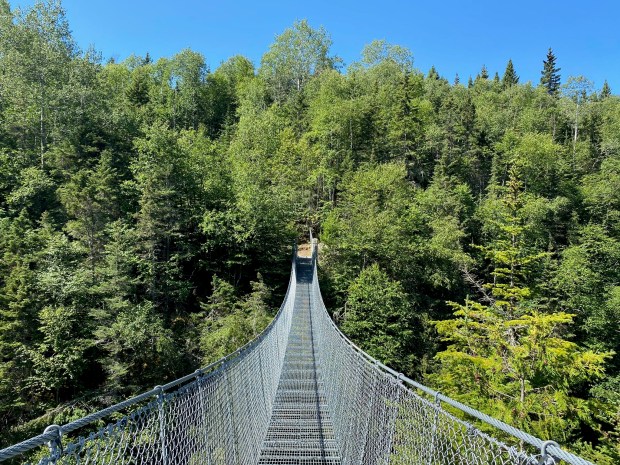
(3) White River Suspension Bridge (18km, rated difficult). The trail follows the Coastal Hiking Trail, passes through a prescribed burn area around Hattie’s Cove, crosses through wetlands, weaves through a mossy forest, and leads to a suspension bridge 23m above the Chigamiwinigum Falls.
A more detailed description of the hike can be found here

Camping
We’ve never camped at Pukaskwa, but there are 67 sites for car camping and 65 sites for backcountry camping.